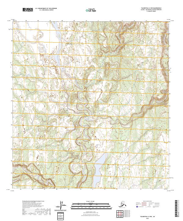
2023 Map of Talkeetna A-2 NW
USGS Topo · Published 2023About this map
Petersville stands as the primary point of human interest in this stretch of the Matanuska-Susitna region, located near the confluence of local drainages. The landscape is defined by a dense network of braided waterways and glacial runoff patterns, with the Kahiltna River serving as the dominant hydrologic feature as it snakes through the center of the sheet. Numerous tributaries including Peters Creek, Treasure Creek, and Shovel Creek carve through the terrain, suggesting a topography shaped by seasonal water movement and low-lying wetlands. To the south, Shulin Lake and Lake Creek provide significant landmarks within the wilderness. The map reveals a land primarily defined by its natural water systems and the solitary outpost of Petersville, reflecting the remote and water-bound character of this Alaskan interior district.
Find a feature on this map
12 named features on this map. Tap any name to fly to it.
Don’t see what you’re looking for? This feature index may not catch every label — zoom into the map to look around manually.
Map Details
Editions of this 2023 Talkeetna A-2 NW Map
This is the sole edition of this map. No revisions or reprints were ever made.
Other maps of this area

1950 · Talkeetna
USGS Topo · 1:250,000

1951 · Talkeetna
USGS Topo · 1:250,000

1954 · Talkeetna A-3
USGS Topo · 1:63,360

1954 · Talkeetna A-2
USGS Topo · 1:63,360

1954 · Talkeetna B-3
USGS Topo · 1:63,360

1954 · Talkeetna B-2
USGS Topo · 1:63,360

1958 · Talkeetna
USGS Topo · 1:250,000

1965 · Talkeetna
USGS Topo · 1:250,000
1994 · Talkeetna B-2
USGS Topo · 1:63,360
1994 · Talkeetna A-2
USGS Topo · 1:63,360