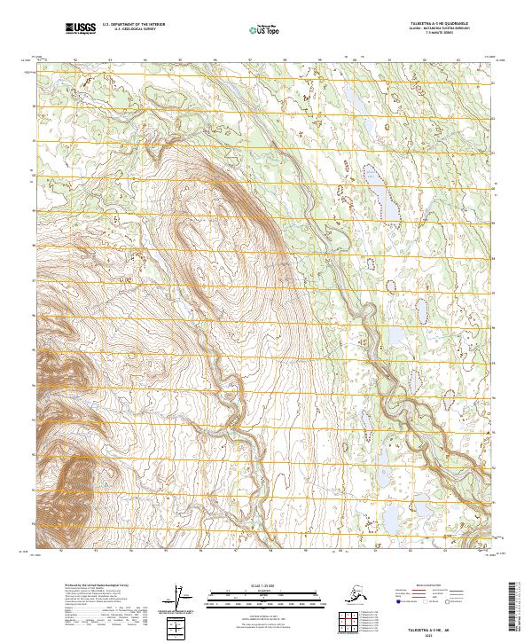
2023 Map of Talkeetna A-3 NE
USGS Topo · Published 2023About this map
Willow Mtn and the surrounding high country of the Yenlo Hills dominate this portion of the Matanuska-Susitna Borough. The landscape is defined by its complex drainage systems, where the meandering Lake Creek serves as a primary arterial waterway, joined by tributaries such as Shovel Creek and Yenlo Creek. This modern survey illustrates a topography of glacial remnants and wetlands, with Shovel Lake situated in the northern reaches. The land is partitioned into several township and range blocks, including t25n r10w and t24n r11w, reflecting the systematic Bureau of Land Management grid that governs this Alaskan interior. Without any established roads or permanent settlements shown on this sheet, the map documents a largely untouched wilderness area as it remained in the early 2020s, providing essential detail for those navigating the region's hydrography and high-altitude terrain.
Find a feature on this map
12 named features on this map. Tap any name to fly to it.
Don’t see what you’re looking for? This feature index may not catch every label — zoom into the map to look around manually.
Map Details
Editions of this 2023 Talkeetna A-3 NE Map
This is the sole edition of this map. No revisions or reprints were ever made.
Other maps of this area

1950 · Talkeetna
USGS Topo · 1:250,000

1951 · Talkeetna
USGS Topo · 1:250,000

1954 · Talkeetna A-3
USGS Topo · 1:63,360

1954 · Talkeetna A-2
USGS Topo · 1:63,360

1954 · Talkeetna B-3
USGS Topo · 1:63,360

1954 · Talkeetna B-2
USGS Topo · 1:63,360

1958 · Talkeetna
USGS Topo · 1:250,000

1965 · Talkeetna
USGS Topo · 1:250,000
1994 · Talkeetna B-2
USGS Topo · 1:63,360
1994 · Talkeetna A-2
USGS Topo · 1:63,360