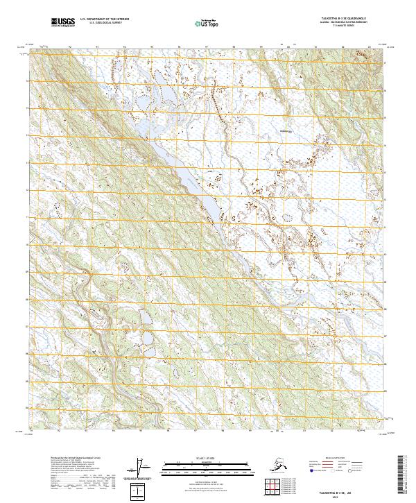
2023 Map of Talkeetna B-3 SE
USGS Topo · Published 2023About this map
Kahiltna River winds through this interior Alaskan landscape, creating a broad valley floor of wetlands and braided channels. The settlement of Petersville sits on the eastern upland edge, representing a historically significant node in the Matanuska-Susitna region's mining and pioneering past. The terrain is defined by a dense network of tributaries including Lake Creek, Summit Creek, and Pickle Creek, which drain the surrounding highlands toward the main river corridor. This drainage pattern reveals a classic glacial valley structure, where multiple smaller streams like Treasure Creek and Home Creek converge within a complex system of marshes and low-lying basins. The lack of major highway infrastructure highlights the remote character of this district, where travel and settlement historically followed the watercourses and natural topography of the river basin.
Find a feature on this map
13 named features on this map. Tap any name to fly to it.
Don’t see what you’re looking for? This feature index may not catch every label — zoom into the map to look around manually.
Map Details
Editions of this 2023 Talkeetna B-3 SE Map
This is the sole edition of this map. No revisions or reprints were ever made.
Other maps of this area

1950 · Talkeetna
USGS Topo · 1:250,000

1951 · Talkeetna
USGS Topo · 1:250,000

1954 · Talkeetna A-3
USGS Topo · 1:63,360

1954 · Talkeetna A-2
USGS Topo · 1:63,360

1954 · Talkeetna B-3
USGS Topo · 1:63,360

1954 · Talkeetna B-2
USGS Topo · 1:63,360

1958 · Talkeetna
USGS Topo · 1:250,000

1965 · Talkeetna
USGS Topo · 1:250,000
1994 · Talkeetna B-2
USGS Topo · 1:63,360
1994 · Talkeetna A-2
USGS Topo · 1:63,360