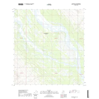
2017 Map of Talkeetna B-4 SW
USGS Topo · Published 2017About this map
The Denali National Preserve defines the heart of this landscape, where the braided channels of the glacier-fed river system dominate the terrain. The confluence of the West Fork Yentna River and the East Fork Yentna River creates a complex network of gravel bars and shifting watercourses. North of this junction, the Midway Lakes are scattered across a low-lying basin, illustrating the hydrologic character of the Matanuska-Susitna region. Smaller tributaries like Fourth of July Creek, Flag Cr, and Rich Cr drain the surrounding slopes, contributing to the larger Yentna River system. This 2017 survey by the U.S. Geological Survey provides a detailed record of the shifting riverbed and topography within the federal preserve, where the lack of human infrastructure emphasizes the raw, natural state of the Alaskan interior.
Find a feature on this map
14 named features on this map. Tap any name to fly to it.
Don’t see what you’re looking for? This feature index may not catch every label — zoom into the map to look around manually.
Map Details
Editions of this 2017 Talkeetna B-4 SW Map
This is the sole edition of this map. No revisions or reprints were ever made.
Other maps of this area

1950 · Talkeetna
USGS Topo · 1:250,000

1951 · Talkeetna
USGS Topo · 1:250,000

1954 · Talkeetna B-4
USGS Topo · 1:63,360

1954 · Talkeetna A-4
USGS Topo · 1:63,360

1958 · Talkeetna A-5
USGS Topo · 1:63,360

1958 · Talkeetna B-5
USGS Topo · 1:63,360

1958 · Talkeetna
USGS Topo · 1:250,000

1965 · Talkeetna
USGS Topo · 1:250,000
2017 · Talkeetna B-4 NE
USGS Topo · 1:25,000
2017 · Talkeetna B-4 SE
USGS Topo · 1:25,000