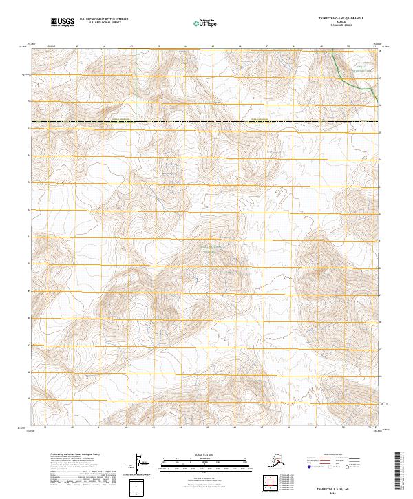
2024 Map of Talkeetna C-5 NE
USGS Topo · Published 2024About this map
Denali National Park and the Denali National Preserve dominate this high-latitude terrain where the northern boundary of Matanuska-Susitna Borough meets Denali Borough. This recent 2024 survey documents a landscape defined by extreme elevation changes and complex drainage patterns, left largely devoid of modern infrastructure or roads. The map provides a critical record of the public land survey system divisions, including t30n r15w and t31n r16w, which serve as the primary framework for navigation in this wilderness. The absence of named human settlements underscores the preservation of the area's natural state within the national park system.
Find a feature on this map
9 named features on this map. Tap any name to fly to it.
Don’t see what you’re looking for? This feature index may not catch every label — zoom into the map to look around manually.
Map Details
Editions of this 2024 Talkeetna C-5 NE Map
This is the sole edition of this map. No revisions or reprints were ever made.
Other maps of this area

1950 · Talkeetna
USGS Topo · 1:250,000

1951 · Talkeetna
USGS Topo · 1:250,000

1958 · Talkeetna D-5
USGS Topo · 1:63,360

1958 · Talkeetna C-4
USGS Topo · 1:63,360

1958 · Talkeetna D-4
USGS Topo · 1:63,360

1958 · Talkeetna C-5
USGS Topo · 1:63,360

1958 · Talkeetna
USGS Topo · 1:250,000

1965 · Talkeetna
USGS Topo · 1:250,000
2014 · Talkeetna C-4 NW
USGS Topo · 1:25,000
2014 · Talkeetna D-4 SW
USGS Topo · 1:25,000