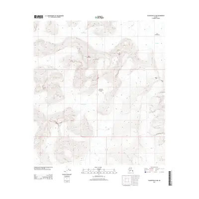
2014 Map of Talkeetna D-2 NW
USGS Topo · Published 2014About this map
Denali National Park encompasses the glaciated high-altitude terrain of the Alaska Range shown in this modern survey. The landscape is defined by the massive convergence of ice flows, including the Ruth Glacier and the West Fork Ruth Glacier, which feed into the expansive Ruth Amphitheater. The topographic detail illustrates the sharp elevation changes between prominent summits like Mount Huntington and The Rooster Comb. These features create a complex alpine environment where the Tokositna Glacier also originates. High-altitude landmarks such as Pease Peak and Pittock Pass highlight the difficulty of navigating this protected wilderness, as the 2014 data provides a clear record of the glacial extent and mountain relief within this iconic national park boundary.
Find a feature on this map
9 named features on this map. Tap any name to fly to it.
Don’t see what you’re looking for? This feature index may not catch every label — zoom into the map to look around manually.
Map Details
Editions of this 2014 Talkeetna D-2 NW Map
This is the sole edition of this map. No revisions or reprints were ever made.
Other maps of this area

1950 · Talkeetna
USGS Topo · 1:250,000

1951 · Talkeetna
USGS Topo · 1:250,000

1952 · Mount McKinley
USGS Topo · 1:250,000

1954 · Mount McKinley A-2
USGS Topo · 1:63,360

1954 · Mount McKinley A-3
USGS Topo · 1:63,360

1958 · Talkeetna D-2
USGS Topo · 1:63,360

1958 · Talkeetna D-3
USGS Topo · 1:63,360

1958 · Talkeetna
USGS Topo · 1:250,000

1958 · Mount McKinley
USGS Topo · 1:250,000

1965 · Talkeetna
USGS Topo · 1:250,000