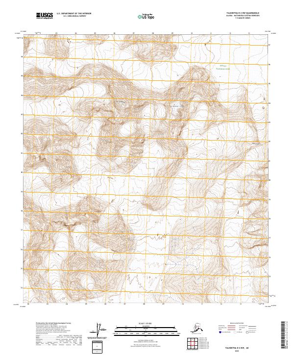
2023 Map of Talkeetna D-2 NW
USGS Topo · Published 2023About this map
Denali National Park encompasses the northern reach of this high-altitude landscape, where the extreme verticality of the Alaska Range is captured through dense contour mapping. The terrain is dominated by massive peaks and ridgelines, most notably the soaring height of Mt Huntington near the center of the sheet. To the east, distinctive geological formations such as The Rooster Comb and Pease Peak rise above the surrounding ice and rock. This 2023 survey serves as a precise record of the glaciated topography and wilderness boundaries in the Matanuska-Susitna Borough, documenting a landscape where human infrastructure is entirely absent in favor of raw natural features and established park limits.
Find a feature on this map
10 named features on this map. Tap any name to fly to it.
Don’t see what you’re looking for? This feature index may not catch every label — zoom into the map to look around manually.
Map Details
Editions of this 2023 Talkeetna D-2 NW Map
This is the sole edition of this map. No revisions or reprints were ever made.
Other maps of this area

1950 · Talkeetna
USGS Topo · 1:250,000

1951 · Talkeetna
USGS Topo · 1:250,000

1952 · Mount McKinley
USGS Topo · 1:250,000

1954 · Mount McKinley A-2
USGS Topo · 1:63,360

1954 · Mount McKinley A-3
USGS Topo · 1:63,360

1958 · Talkeetna D-2
USGS Topo · 1:63,360

1958 · Talkeetna D-3
USGS Topo · 1:63,360

1958 · Talkeetna
USGS Topo · 1:250,000

1958 · Mount McKinley
USGS Topo · 1:250,000

1965 · Talkeetna
USGS Topo · 1:250,000