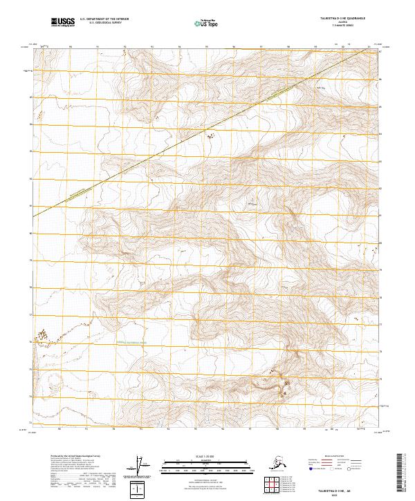
2023 Map of Talkeetna D-3 NE
USGS Topo · Published 2023About this map
Denali National Park and the Denali Wilderness meet at the border of the Denali Borough Matanuska-Susitna Borough in this high-altitude Alaskan landscape. This survey documents the extreme relief of the Alaska Range, dominated by the massive presence of Mt Hunter and Mt Stevens. The terrain is characterized by massive glacial systems and steep alpine passes, most notably at Ruth Gap in the northeastern portion of the quadrangle. The map highlights the complex township and range intersections where T22S R19W, T33N R10W, and several other survey blocks converge, illustrating the logistical challenge of mapping this protected wilderness area. It serves as a precise record of the physical topography within one of the most iconic protected landscapes in the United States.
Find a feature on this map
13 named features on this map. Tap any name to fly to it.
Don’t see what you’re looking for? This feature index may not catch every label — zoom into the map to look around manually.
Map Details
Editions of this 2023 Talkeetna D-3 NE Map
This is the sole edition of this map. No revisions or reprints were ever made.
Other maps of this area

1950 · Talkeetna
USGS Topo · 1:250,000

1951 · Talkeetna
USGS Topo · 1:250,000

1952 · Mount McKinley
USGS Topo · 1:250,000

1954 · Mount McKinley A-2
USGS Topo · 1:63,360

1954 · Mount McKinley A-3
USGS Topo · 1:63,360

1958 · Talkeetna D-2
USGS Topo · 1:63,360

1958 · Talkeetna D-3
USGS Topo · 1:63,360

1958 · Talkeetna
USGS Topo · 1:250,000

1958 · Mount McKinley
USGS Topo · 1:250,000

1965 · Talkeetna
USGS Topo · 1:250,000