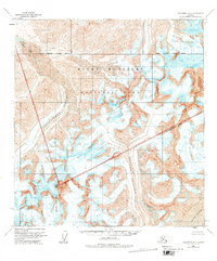
1958 Map of Talkeetna D-4
USGS Topo · Published 1977About this map
Mount Russell dominates the southern portion of this high-altitude landscape, situated along the Matanuska-Susitna Borough line. This 1958 survey captures a frozen wilderness defined by massive ice flows, including the Chedotlothna Glacier, Yentna Glacier, and Lacuna Glacier. The northern reaches of the sheet are protected within Mount McKinley National Park, a region where the South Boundary Fairbanks Meridian marks a critical surveying baseline.
Find a feature on this map
10 named features on this map. Tap any name to fly to it.
Don’t see what you’re looking for? This feature index may not catch every label — zoom into the map to look around manually.
Map Details
Editions of this 1958 Talkeetna D-4 Map
2 editions found

Other maps of this area

1950 · Talkeetna
USGS Topo · 1:250,000

1951 · Talkeetna
USGS Topo · 1:250,000

1952 · Mount McKinley
USGS Topo · 1:250,000

1952 · Mount McKinley A-5
USGS Topo · 1:63,360

1953 · Mount McKinley A-4
USGS Topo · 1:63,360

1954 · Mount McKinley A-4
USGS Topo · 1:63,360

1954 · Mount McKinley A-5
USGS Topo · 1:63,360

1954 · Mount McKinley A-3
USGS Topo · 1:63,360

1958 · Talkeetna D-5
USGS Topo · 1:63,360

1958 · Talkeetna C-4
USGS Topo · 1:63,360