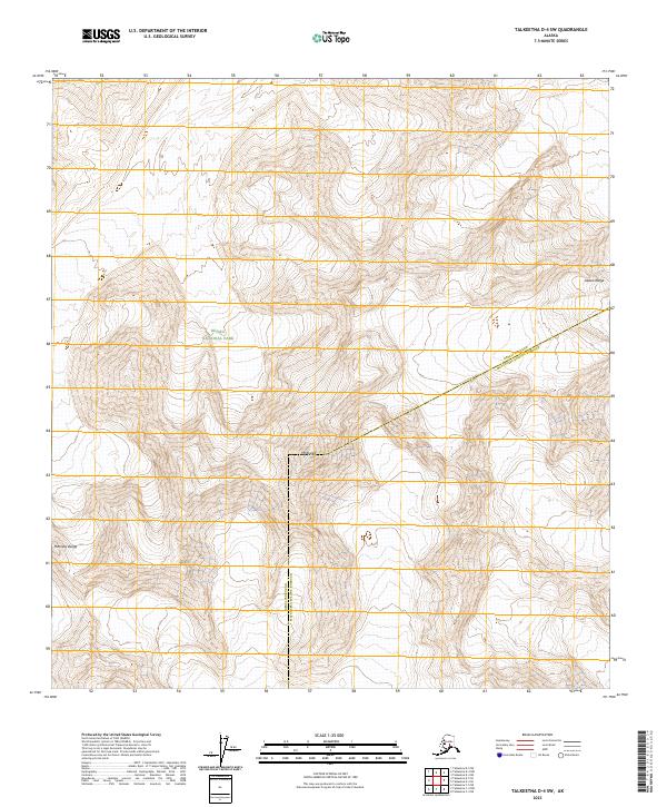
2023 Map of Talkeetna D-4 SW
USGS Topo · Published 2023About this map
Mt Russell stands as a prominent landmark in this high-altitude section of the Alaska Range, where the boundary between the Denali Borough and Matanuska-Susitna Borough cuts across the glaciated terrain. This 2023 survey documents the intersection of the Denali National Park and the protected Denali Wilderness, capturing a landscape of extreme relief and permanent ice. The map traces the transition from the peaks of the McKinley Range into the vast townships of the Alaska interior. Unlike more settled regions, the lack of roads or structures emphasizes the primitive state of this wilderness, which remains primarily defined by its topographic extremes and administrative conservation boundaries.
Find a feature on this map
12 named features on this map. Tap any name to fly to it.
Don’t see what you’re looking for? This feature index may not catch every label — zoom into the map to look around manually.
Map Details
Editions of this 2023 Talkeetna D-4 SW Map
This is the sole edition of this map. No revisions or reprints were ever made.
Other maps of this area

1950 · Talkeetna
USGS Topo · 1:250,000

1951 · Talkeetna
USGS Topo · 1:250,000

1958 · Talkeetna D-5
USGS Topo · 1:63,360

1958 · Talkeetna C-4
USGS Topo · 1:63,360

1958 · Talkeetna D-4
USGS Topo · 1:63,360

1958 · Talkeetna C-5
USGS Topo · 1:63,360

1958 · Talkeetna
USGS Topo · 1:250,000

1965 · Talkeetna
USGS Topo · 1:250,000
2014 · Talkeetna D-4 SE
USGS Topo · 1:25,000
2014 · Talkeetna C-4 NW
USGS Topo · 1:25,000