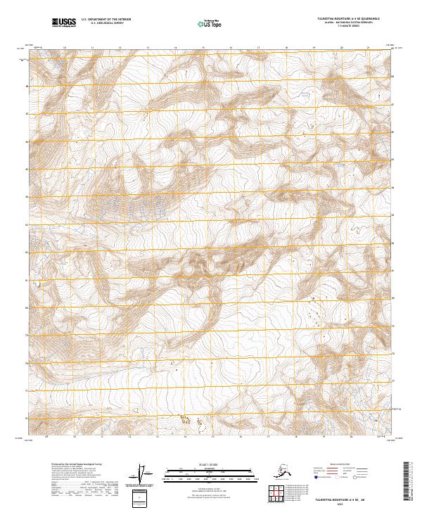
2023 Map of Talkeetna Mountains A-4 SE
USGS Topo · Published 2023About this map
Talkeetna Glacier and Chickaloon Glacier dominate this remote expanse of the Talkeetna Mountains, where the high-altitude landscape is defined by massive ice fields and steep glacial valleys. This 2023 survey provides a contemporary record of these frozen landmarks within the Matanuska-Susitna Borough, illustrating the intricate drainage patterns and elevation contours that shape the region's hydrology. The map serves as a primary reference for understanding the geography of Southcentral Alaska's interior ranges, documenting the current extent of ice and the underlying terrain. These features are situated within several townships, including t24n r4e and t23n r5e, marking the transition between the rugged peaks and the river systems they feed.
Find a feature on this map
10 named features on this map. Tap any name to fly to it.
Don’t see what you’re looking for? This feature index may not catch every label — zoom into the map to look around manually.
Map Details
Editions of this 2023 Talkeetna Mountains A-4 SE Map
This is the sole edition of this map. No revisions or reprints were ever made.
Other maps of this area

1948 · Anchorage D-4
USGS Topo · 1:63,360

1949 · Anchorage D-5
USGS Topo · 1:63,360

1949 · Talkeetna Mountains A-4
USGS Topo · 1:63,360

1950 · Talkeetna Mountains
USGS Topo · 1:250,000

1951 · Anchorage
USGS Topo · 1:250,000

1951 · Talkeetna Mountains A-3
USGS Topo · 1:63,360

1952 · Anchorage D-5
USGS Topo · 1:63,360

1952 · Anchorage D-4
USGS Topo · 1:63,360
1952 · Talkeetna Mountains A-3
USGS Topo · 1:63,360
1954 · Talkeetna Mountains A-4
USGS Topo · 1:63,360