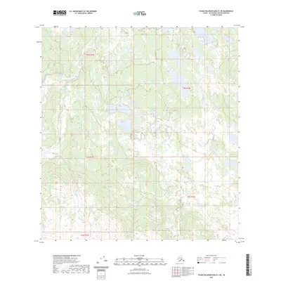
2023 Map of Talkeetna Mountains B-1 NE
USGS Topo · Published 2023About this map
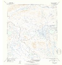
Tyone Creek dominates the eastern drainage of this high-latitude landscape, carving a winding path through a series of expansive wetlands and small glacial lakes. This portion of the Matanuska-Susitna region reflects the transitional character of the interior, where the headwaters of Tolson Creek and Sanona Creek converge amidst complex topography. The map illustrates a strictly natural domain, defined more by its hydrologic network and the formal divisions of the Public Land Survey System than by human settlement. The absence of roads or established trails highlights the area's role as a remote wilderness corridor, where terrain is measured by the intersections of t28n r12e and t8n r10w rather than populated centers.
Find a feature on this map
8 named features on this map. Tap any name to fly to it.
Don’t see what you’re looking for? This feature index may not catch every label — zoom into the map to look around manually.
Map Details
Editions of this 2023 Talkeetna Mountains B-1 NE Map
This is the sole edition of this map. No revisions or reprints were ever made.
Other maps of this area

1950 · Talkeetna Mountains
USGS Topo · 1:250,000

1950 · Gulkana B-6
USGS Topo · 1:63,360

1951 · Gulkana
USGS Topo · 1:250,000

1951 · Talkeetna Mountains B-1
USGS Topo · 1:63,360

1951 · Talkeetna Mountains C-1
USGS Topo · 1:63,360

1951 · Gulkana C-6
USGS Topo · 1:63,360
1952 · Gulkana B-6
USGS Topo · 1:63,360
1952 · Talkeetna Mountains C-1
USGS Topo · 1:63,360
1952 · Talkeetna Mountains B-1
USGS Topo · 1:63,360
1952 · Gulkana C-6
USGS Topo · 1:63,360