
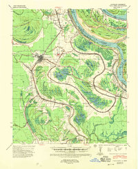
1939 Map of Talla Bena
USGS Topo · Published 1941About this map
Tallulah serves as the central hub of this 1939 survey, situated at the intersection of the Illinois Central and Missouri Pacific railroads. The landscape is defined by the shifting course of the Mississippi River, which forms the boundary between Louisiana and Mississippi. This era of river management is documented by features like the Cut-Off 1934 and the Millikens Bend Revet, reflecting efforts to stabilize the waterway near Millikens Bend.
Find a feature on this map
83 named features on this map. Tap any name to fly to it.
Don’t see what you’re looking for? This feature index may not catch every label — zoom into the map to look around manually.
Map Details
Editions of this 1939 Talla Bena Map
2 editions found
Other maps of this area

1909 · Millikens Bend
USGS Topo · 1:24,000

1909 · Tallulah
USGS Topo · 1:24,000

1909 · Mound
USGS Topo · 1:24,000

1910 · Mound
USGS Topo · 1:31,680

1918 · Vicksburg
USGS Topo · 1:62,500

1935 · Waverly
USGS Topo · 1:62,500

1935 · Shackleford Lake
USGS Topo · 1:62,500

1939 · Onward
USGS Topo · 1:62,500

1939 · Yokena
USGS Topo · 1:62,500

1939 · Alsatia
USGS Topo · 1:62,500