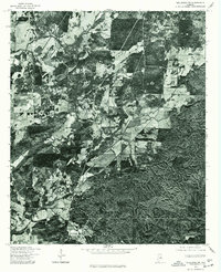
1975 Map of Talladega SW
USGS Topo · Published 1977About this map
Winterboro and its surrounding agricultural landscape are captured in high-resolution detail through this 1975 aerial orthophotograph. The settlement patterns of central Talladega County are clearly visible, illustrating how local roads and farmsteads branched out from core communities like Sycamore in the south and Alpine along the western edge. Unlike traditional topographic maps, this imagery reveals the exact density of forests and the precise boundaries of cleared fields during the mid-1970s. This survey, conducted in cooperation with the Soil Conservation Service, documents the land use and rural infrastructure of the era, providing a raw visual record of the region’s topography and settlement footprint.
Find a feature on this map
3 named features on this map. Tap any name to fly to it.
Don’t see what you’re looking for? This feature index may not catch every label — zoom into the map to look around manually.
Map Details
Editions of this 1975 Talladega SW Map
This is the sole edition of this map. No revisions or reprints were ever made.
Other maps of this area

1890 · Talladega
USGS Topo · 1:125,000

1892 · Talladega
USGS Topo · 1:125,000

1915 · Gantts Quarry
USGS Topo · 1:48,000

1917 · Gantts Quarry
USGS Topo · 1:62,500

1943 · Talladega
USGS Topo · 1:62,500

1944 · Goodwater
USGS Topo · 1:62,500

1946 · Talladega
USGS Topo · 1:62,500

1947 · Goodwater
USGS Topo · 1:62,500

1951 · Laniers
USGS Topo · 1:24,000

1953 · Birmingham
USGS Topo · 1:250,000