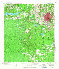
1940 Map of Tallahassee
USGS Topo · Published 1966About this map
The capital city Tallahassee centers this pre-war landscape, showing a period of significant growth for the State College for Women and the Florida Agricultural and Mechanical College. The developed core is surrounded by an extensive network of rural churches and schools that served the outlying Leon County farming communities, including the Vaughn Chapel and the Richardson Sch. To the west, the reservoir of Lake Talquin and the wide expanse of the Apalachicola National Forest dominate the terrain, reflecting the early 20th-century focus on forest management and hydroelectric development. The Seaboard Air Line railroad provides a critical transit spine through the region, connecting the small settlement of Midway to the city. Notable surveyors such as G. E. Sisson and H. F. Ewing documented this transition from a concentrated administrative hub to a landscape increasingly influenced by the Municipal Airport and organized timberlands.
Find a feature on this map
62 named features on this map. Tap any name to fly to it.
Don’t see what you’re looking for? This feature index may not catch every label — zoom into the map to look around manually.
Map Details
Editions of this 1940 Tallahassee Map
2 editions found
Other maps of this area

1940 · Tallahassee
USGS Topo · 1:62,500

1940 · Arran
USGS Topo · 1:62,500

1942 · Tallahassee
USGS Topo · 1:62,500

1943 · Arran
USGS Topo · 1:62,500

1943 · Tallahassee
USGS Topo · 1:62,500

1943 · Lake Talquin
USGS Topo · 1:62,500

1945 · Bradwell Bay
USGS Topo · 1:31,680

1954 · Lafayette
USGS Topo · 1:24,000

1954 · Woodville
USGS Topo · 1:24,000

1954 · St. Marks
USGS Topo · 1:24,000