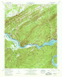
1966 Map of Tallassee
USGS Topo · Published 1968About this map
Chilhowee Lake and the developing Tellico Lake dominate this mid-1960s landscape along the border of Blount and Monroe Counties. The map captures a critical period of transition for the Little Tennessee River valley, showing the area as the Chilhowee Dam had already transformed the eastern reach, while downstream, land was being prepared for controlled inundation to the 813-foot level. This hydro-electric and navigational development reshaped the historic river corridor, which was once defined by features like Chilhowee Shoals and islands such as Harrison Island and Kirkland Island.
Find a feature on this map
69 named features on this map. Tap any name to fly to it.
Don’t see what you’re looking for? This feature index may not catch every label — zoom into the map to look around manually.
Map Details
Editions of this 1966 Tallassee Map
3 editions found
Other maps of this area

1886 · Knoxville
USGS Topo · 1:125,000

1892 · Knoxville
USGS Topo · 1:125,000

1893 · Murphy
USGS Topo · 1:125,000

1894 · Knoxville
USGS Topo · 1:125,000

1895 · Loudon
USGS Topo · 1:125,000

1895 · Knoxville
USGS Topo · 1:125,000

1901 · Knoxville
USGS Topo · 1:125,000

1914 · Murphy
USGS Topo · 1:125,000

1933 · Haw Knob
USGS Topo · 1:48,000

1933 · Whiteoak Flats
USGS Topo · 1:24,000