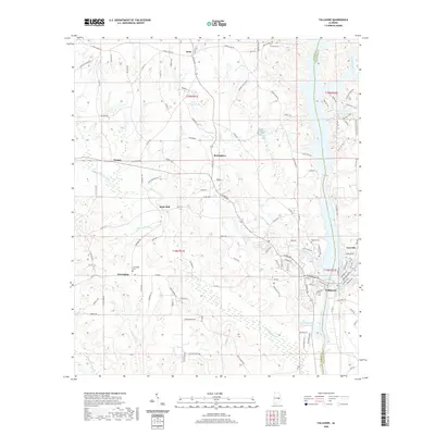
2020 Map of Tallassee
USGS Topo · Published 2020About this map
The Tallapoosa River forms a major geographic boundary on this 2020 map, separating Elmore Co and Tallapoosa Co as it flows south toward Tallassee. This modern survey reveals the persistent settlement patterns of central Alabama, where smaller communities like Kent, Burlington, and Neman are connected by a network of county roads including Chana Creek Rd and Upper River Rd. Local heritage is preserved in sites such as Rosehill Cem and Friendship Cem, which sit near the established towns of Carrville and Friendship. The landscape is defined by its drainages, with Wallahatchee Cr and Soughahatchee Creek feeding into the larger river system. To the north, Annie T Gregory Lake and various residential developments like Coon Creek Landing Rd illustrate how modern recreation and housing have integrated with the historical rural topography.
Find a feature on this map
124 named features on this map. Tap any name to fly to it.
Don’t see what you’re looking for? This feature index may not catch every label — zoom into the map to look around manually.
Map Details
Editions of this 2020 Tallassee Map
This is the sole edition of this map. No revisions or reprints were ever made.
Other maps of this area

1901 · Wetumpka
USGS Topo · 1:125,000

1901 · Wetumpka
USGS Topo · 1:62,500

1903 · Wetumpka
USGS Topo · 1:125,000

1906 · Dadeville
USGS Topo · 1:125,000

1953 · Montgomery
USGS Topo · 1:250,000

1955 · Phenix City
USGS Topo · 1:250,000

1956 · Montgomery
USGS Topo · 1:250,000

1957 · Phenix City
USGS Topo · 1:250,000

1957 · Montgomery
USGS Topo · 1:250,000

1958 · Phenix City
USGS Topo · 1:250,000