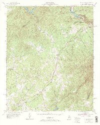
1953 Map of Tallulah Falls
USGS Topo · Published 1972About this map
Tallulah Falls and its famous gorge anchor this 1950s study of the Chattahoochee National Forest boundary along the Tallulah River. The map captures the industrial and recreational infrastructure of the era, from the Incline Railway near the Tallulah Falls dam to the Panther Creek Picnic Area. The landscape is dotted with several rural landmarks of significant genealogical interest, including New Liberty Ch, Ebenezer Ch, and the Kollock Cem near Hollywood.
Find a feature on this map
54 named features on this map. Tap any name to fly to it.
Don’t see what you’re looking for? This feature index may not catch every label — zoom into the map to look around manually.
Map Details
Editions of this 1953 Tallulah Falls Map
4 editions found
Other maps of this area

1886 · Dahlonega
USGS Topo · 1:125,000

1886 · Walhalla
USGS Topo · 1:125,000

1892 · Dahlonega
USGS Topo · 1:125,000

1892 · Walhalla
USGS Topo · 1:125,000

1896 · Walhalla
USGS Topo · 1:125,000

1896 · Dahlonega
USGS Topo · 1:125,000

1903 · Dahlonega
USGS Topo · 1:125,000

1953 · Tallulah Falls
USGS Topo · 1:24,000

1954 · Greenville
USGS Topo · 1:250,000
1957 · Lake Burton
USGS Topo · 1:24,000