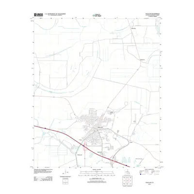
2012 Map of Tallulah
USGS Topo · Published 2012About this map
Tallulah serves as the central hub of this Madison Parish survey, situated at the confluence of several key bayous and regional transit routes. The landscape is defined by its complex drainage network, where Roundaway Bayou and Brushy Bayou meet near the town center, while Panola Bayou winds through the northern outskirts. Smaller neighboring settlements like Richmond and Englewood are clearly defined, showing the distribution of local communities in the early 21st century. For those researching family history, the map specifically locates several burial sites, including Oakwood Cem, Morning Crest Cem, and Silver Cross Cem. Aviation history is also represented through the presence of Scott Airport and Marlin Airport, reflecting the area's ongoing connection to regional commerce and transportation.
Find a feature on this map
72 named features on this map. Tap any name to fly to it.
Don’t see what you’re looking for? This feature index may not catch every label — zoom into the map to look around manually.
Map Details
Editions of this 2012 Tallulah Map
This is the sole edition of this map. No revisions or reprints were ever made.
Other maps of this area

1909 · Millikens Bend
USGS Topo · 1:24,000

1909 · Tallulah
USGS Topo · 1:24,000

1909 · Mound
USGS Topo · 1:24,000

1910 · Mound
USGS Topo · 1:31,680

1935 · Waverly
USGS Topo · 1:62,500

1939 · Talla Bena
USGS Topo · 1:62,500

1939 · Alsatia
USGS Topo · 1:62,500

1955 · Jackson
USGS Topo · 1:250,000

1959 · Mitchiner
USGS Topo · 1:62,500

1961 · Jackson
USGS Topo · 1:250,000