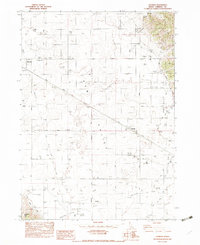
1982 Map of Talmage
USGS Topo · Published 1983About this map
G E M Valley serves as the agricultural heart of this Caribou County landscape, where the Union Pacific railroad corridor connects the settlements of Bancroft and Talmage. The map illustrates a highly managed water system essential for high-altitude farming, featuring the Soda Canal, Int Ditch, and numerous Int Ponds that redistribute flow from Tenmile Creek. This infrastructure supports specialized local industry, evidenced by the Quallman Grain Tanks and a series of Borrow Pits near the tracks.
Find a feature on this map
31 named features on this map. Tap any name to fly to it.
Don’t see what you’re looking for? This feature index may not catch every label — zoom into the map to look around manually.
Map Details
Editions of this 1982 Talmage Map
This is the sole edition of this map. No revisions or reprints were ever made.
Other maps of this area

1914 · Henry
USGS Topo · 1:48,000

1916 · Henry
USGS Topo · 1:62,500

1917 · Portneuf
USGS Topo · 1:62,500

1948 · Bancroft
USGS Topo · 1:62,500

1948 · Soda Springs
USGS Topo · 1:62,500

1949 · Bancroft
USGS Topo · 1:62,500

1949 · Soda Springs
USGS Topo · 1:62,500

1955 · Preston
USGS Topo · 1:250,000

1958 · Preston
USGS Topo · 1:250,000

1962 · Preston
USGS Topo · 1:250,000