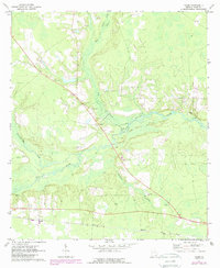
1971 Map of Talmo
USGS Topo · Published 1988About this map
The Satilla River carves a winding path through this Ware County landscape, joined by tributaries like Seventeen Mile Creek and Hog Creek. The settlement of Talmo serves as a central point along the diagonal route of Highway 82, surrounded by several smaller communities and crossroads including Fairfax, Hasty, and Sappville. This 1971 field-checked survey reveals a rural society anchored by localized religious and family landmarks. Numerous country churches, such as Oak Grove Ch and Newbern Ch, are distributed throughout the area, often situated near family-named cemeteries like Chauncey Cem and Walden Cem. The presence of multiple Sandpit locations along the river and creek beds indicates the local extraction industry of the era, while a Radio Tower stands as a more modern technological feature amidst the traditional agricultural and woodland terrain of southern Georgia.
Find a feature on this map
22 named features on this map. Tap any name to fly to it.
Don’t see what you’re looking for? This feature index may not catch every label — zoom into the map to look around manually.
Map Details
Editions of this 1971 Talmo Map
2 editions found
Other maps of this area

1953 · Waycross
USGS Topo · 1:250,000

1958 · Waycross
USGS Topo · 1:250,000

1967 · Waycross West
USGS Topo · 1:24,000

1967 · Pine Valley
USGS Topo · 1:24,000

1968 · Cogdell
USGS Topo · 1:24,000

1971 · Dixie Union
USGS Topo · 1:24,000

1971 · Wilsonville
USGS Topo · 1:24,000

1971 · Beach
USGS Topo · 1:24,000

1971 · Axson
USGS Topo · 1:24,000

1971 · Talmo
USGS Topo · 1:24,000