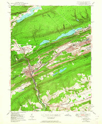
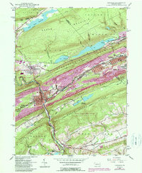
1947 Map of Tamaqua
USGS Topo · Published 1964About this map
Industrial coal operations and steep Appalachian ridges define this 1947 snapshot of the Panther Valley region. Tamaqua sits at the confluence of the Little Schuylkill River, Panther Creek, and Wabash Creek, serving as a critical rail hub where the Reading and Central RR of New Jersey lines converge. The landscape is heavily marked by the anthracite industry, with extensive tailings piles, slum deposits, and mines lining the valley between Nesquehoning Mountain and Pisgah Ridge.
Find a feature on this map
52 named features on this map. Tap any name to fly to it.
Don’t see what you’re looking for? This feature index may not catch every label — zoom into the map to look around manually.
Map Details
Editions of this 1947 Tamaqua Map
5 editions found
Other maps of this area

1889 · Hazleton
USGS Topo · 1:62,500

1889 · Pottsville
USGS Topo · 1:62,500

1891 · Hazleton
USGS Topo · 1:62,500

1891 · Pottsville
USGS Topo · 1:62,500

1892 · Mahanoy
USGS Topo · 1:62,500

1893 · Hazleton
USGS Topo · 1:62,500

1893 · Mahanoy
USGS Topo · 1:62,500

1909 · Hamburg
USGS Topo · 1:62,500

1911 · Hamburg
USGS Topo · 1:62,500

1944 · Orwigsburg
USGS Topo · 1:24,000