
1953 Map of Tamarack Ranch
USGS Topo · Published 1954About this map
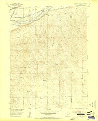
South Platte River hydrology dominates this mid-century Logan County landscape, where an intricate network of irrigation infrastructure supports the high plains ranching economy. The map documents the engineering of the valley through features like the Harmony Ditch, Settlers Ditch, and a specific Siphon and Flume system designed to move water across the arid terrain. Much of the river corridor is protected within the Colorado Game and Fish Reserve, which follows the braided channels and islands of the Platte, including Long Island. Beyond the lush river bottom, the map transitions to the high, windmill-dotted prairie where family-named operations like Tamarack Ranch, Barden Ranch, and Yost Ranch define the settlement pattern. The presence of the Union Pacific railroad in the northwest corner highlights the vital transportation link that connected these remote ranching outposts to larger markets.
Find a feature on this map
17 named features on this map. Tap any name to fly to it.
Don’t see what you’re looking for? This feature index may not catch every label — zoom into the map to look around manually.
Map Details
Editions of this 1953 Tamarack Ranch Map
5 editions found
Other maps of this area

1952 · Marks Butte
USGS Topo · 1:24,000

1953 · Crook
USGS Topo · 1:24,000

1953 · Twin Buttes
USGS Topo · 1:24,000

1953 · Julesburg Reservoir
USGS Topo · 1:24,000

1953 · Sedgwick
USGS Topo · 1:24,000

1954 · Sterling
USGS Topo · 1:250,000

1958 · Sterling
USGS Topo · 1:250,000

1962 · Fleming
USGS Topo · 1:24,000

1962 · Haxtun East
USGS Topo · 1:24,000

1962 · Haxtun West
USGS Topo · 1:24,000