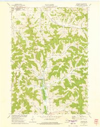
1973 Map of Tamarack
USGS Topo · Published 1975About this map
Arcadia and the smaller settlement of Tamarack anchor this 1973 survey of the Driftless Area’s dissected plateau. The landscape is defined by its characteristic coulee topography, where steep ridges like Arcadia Ridge and Oak Ridge separate deep valleys including Meyers Valley and the American Valley. This map captures a rural network of farmsteads and narrow bottomlands before modern agricultural intensification, centered on the Tamarack Creek State Wildlife Area. Local heritage is evident in the placement of several historic burial grounds, such as Arcadia Cem and Calvary Cem, as well as the Tamarack Ch and Tamarack Cem which served the isolated valley communities. Numerous small quarries are scattered throughout the hillsides, reflecting the local extraction of stone for road building and construction in this pocket of Trempealeau County.
Find a feature on this map
30 named features on this map. Tap any name to fly to it.
Don’t see what you’re looking for? This feature index may not catch every label — zoom into the map to look around manually.
Map Details
Editions of this 1973 Tamarack Map
This is the sole edition of this map. No revisions or reprints were ever made.
Other maps of this area

1926 · Whitehall
USGS Topo · 1:62,500

1929 · Whitehall
USGS Topo · 1:62,500

1929 · Fountain City
USGS Topo · 1:62,500

1929 · Galesville
USGS Topo · 1:62,500

1932 · Gilmanton
USGS Topo · 1:62,500

1934 · Winona
USGS Topo · 1:62,500

1937 · Winona
USGS Topo · 1:62,500

1953 · Eau Claire
USGS Topo · 1:250,000

1958 · Eau Claire
USGS Topo · 1:250,000

1964 · Eau Claire
USGS Topo · 1:250,000