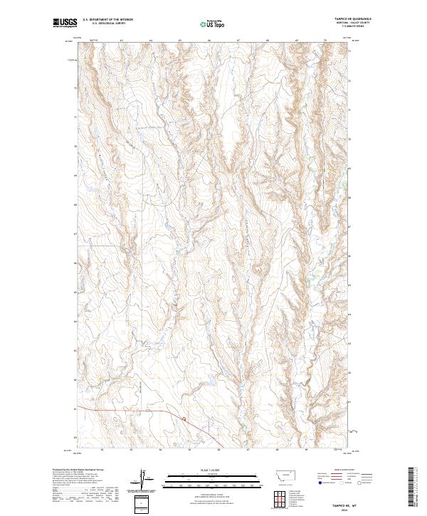
2024 Map of Tampico NE
USGS Topo · Published 2024About this map
Black Coulee and Unger Coulee define the dissected breaks of this Valley County landscape, where the prairie is carved by a network of seasonal drainages. The area is dominated by the watershed of Bear Creek, which is joined by Brush Fork as it winds through the western sections. Evidence of rural water management is visible at Reservoir Number Four, a key catchment in an otherwise arid environment.
Find a feature on this map
16 named features on this map. Tap any name to fly to it.
Don’t see what you’re looking for? This feature index may not catch every label — zoom into the map to look around manually.
Map Details
Editions of this 2024 Tampico NE Map
This is the sole edition of this map. No revisions or reprints were ever made.
Other maps of this area

1919 · Boundary
USGS Topo · 1:125,000

1943 · Glasgow
USGS Topo · 1:125,000

1954 · Glasgow
USGS Topo · 1:250,000

1957 · Glasgow
USGS Topo · 1:250,000

1958 · Glasgow
USGS Topo · 1:250,000

1969 · Cornwell Reservoir
USGS Topo · 1:24,000
1969 · Tampico
USGS Topo · 1:24,000
1969 · Chapman Coulee
USGS Topo · 1:24,000

1969 · Vandalia
USGS Topo · 1:24,000
1969 · Tampico NE
USGS Topo · 1:24,000