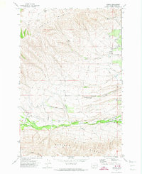
1971 Map of Tampico
USGS Topo · Published 1974About this map
The settlement of Tampico serves as a focal point in this 1971 study, situated where Ahtanum Creek North Fork and Ahtanum Creek South Fork converge. The landscape is defined by the significant elevation changes between Cowiche Mountain to the north and Ahtanum Ridge to the south. Central to the area's development is the Yakima Indian Reservation Boundary, which follows the course of Ahtanum Creek.
Find a feature on this map
42 named features on this map. Tap any name to fly to it.
Don’t see what you’re looking for? This feature index may not catch every label — zoom into the map to look around manually.
Map Details
Editions of this 1971 Tampico Map
2 editions found
Other maps of this area

1899 · Ellensburg
USGS Topo · 1:125,000

1901 · Ellensburg
USGS Topo · 1:125,000

1937 · White Swan
USGS Topo · 1:125,000

1950 · Yakima
USGS Topo · 1:250,000

1957 · Yesmowit Canyon
USGS Topo · 1:24,000

1958 · Fort Simcoe
USGS Topo · 1:62,500

1958 · Wiley City
USGS Topo · 1:24,000

1958 · White Swan
USGS Topo · 1:24,000
1958 · Medicine Valley
USGS Topo · 1:24,000

1958 · Naches
USGS Topo · 1:24,000