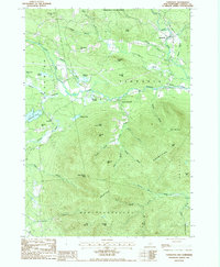
1987 Map of Tamworth
USGS Topo · Published 1987About this map
The Swift River and Bearcamp River define the local drainage of this northern Carroll County landscape in the late twentieth century. Settlement is concentrated along these watercourses, with the primary village of Tamworth joined by the smaller communities of Whittier, South Tamworth, and Bennett Corners. The southern portion of the sheet is dominated by the northern reaches of the Ossipee Mountains, where high peaks like Black Snout Mtn and Faraway Mtn contrast with the agricultural and residential corridors below.
Find a feature on this map
56 named features on this map. Tap any name to fly to it.
Don’t see what you’re looking for? This feature index may not catch every label — zoom into the map to look around manually.
Map Details
Editions of this 1987 Tamworth Map
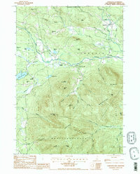
2 editions found
Other maps of this area

1909 · Winnepesaukee
USGS Topo · 1:62,500

1928 · Wolfeboro
USGS Topo · 1:62,500

1930 · Ossipee Lake
USGS Topo · 1:62,500

1931 · Mt. Chocorua
USGS Topo · 1:62,500

1949 · Portland
USGS Topo · 1:250,000

1956 · Winnipesaukee
USGS Topo · 1:62,500

1956 · Portland
USGS Topo · 1:250,000

1958 · Ossipee Lake
USGS Topo · 1:62,500

1958 · Wolfeboro
USGS Topo · 1:62,500

1958 · Mt. Chocorua
USGS Topo · 1:62,500