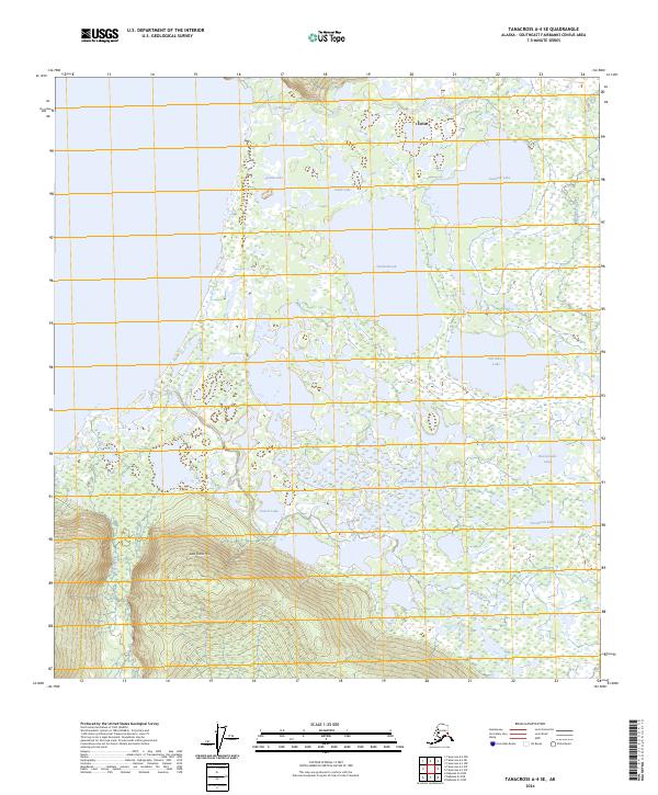
2024 Map of Tanacross A-4 SE
USGS Topo · Published 2024About this map
The settlement of Tetlin sits at the northern edge of a complex wetland and river system within the Southeast Fairbanks Census Area. This landscape is defined by its intricate network of lakes and waterways, where the Tetlin River and Katukna River meander through a broad basin. To the south, the elevation rises toward Last Tetlin Hill, providing a clear geographic transition from the low-lying lake district to the surrounding uplands.
Find a feature on this map
21 named features on this map. Tap any name to fly to it.
Don’t see what you’re looking for? This feature index may not catch every label — zoom into the map to look around manually.
Map Details
Editions of this 2024 Tanacross A-4 SE Map
This is the sole edition of this map. No revisions or reprints were ever made.
Other maps of this area

1948 · Tanacross A-3
USGS Topo · 1:63,360

1948 · Tanacross A-4
USGS Topo · 1:63,360

1949 · Tanacross
USGS Topo · 1:250,000

1950 · Tanacross
USGS Topo · 1:250,000

1950 · Nabesna
USGS Topo · 1:250,000

1951 · Nabesna
USGS Topo · 1:250,000

1952 · Tanacross A-4
USGS Topo · 1:63,360

1952 · Tanacross A-3
USGS Topo · 1:63,360

1954 · Nabesna D-3
USGS Topo · 1:63,360

1954 · Nabesna D-4
USGS Topo · 1:63,360