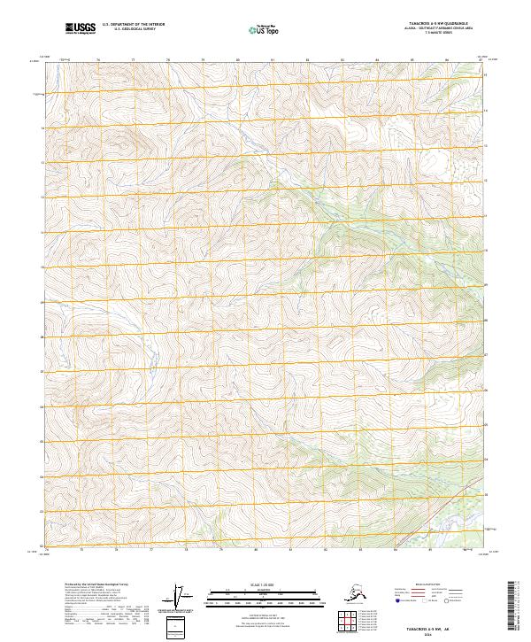
2024 Map of Tanacross A-5 NW
USGS Topo · Published 2024About this map
High-altitude interior Alaskan wilderness dominates this terrain near the eastern end of the Alaska Range. The landscape is defined by its drainage systems, most notably the meandering paths of Clearwater Creek and Natohona Creek, which cut through the steep topography of the Southeast Fairbanks Census Area. Evidence of human infrastructure is minimal, restricted to the southeastern corner where the Tok Cutoff Highway runs parallel to the Tok River. This corridor serves as a critical transportation link through the subarctic region, connecting isolated interior points to the broader state highway system. The map provides a detailed view of the township and range divisions, such as t17n r11e and t16n r10e, overlaying a complex network of ridgelines and creek beds like Shindata Creek that remain largely untouched by development.
Find a feature on this map
9 named features on this map. Tap any name to fly to it.
Don’t see what you’re looking for? This feature index may not catch every label — zoom into the map to look around manually.
Map Details
Editions of this 2024 Tanacross A-5 NW Map
This is the sole edition of this map. No revisions or reprints were ever made.
Other maps of this area

1948 · Tanacross B-5
USGS Topo · 1:63,360

1948 · Tanacross A-6
USGS Topo · 1:63,360

1948 · Tanacross A-5
USGS Topo · 1:63,360

1949 · Tanacross
USGS Topo · 1:250,000

1949 · Tanacross A-5
USGS Topo · 1:63,360

1949 · Tanacross B-6
USGS Topo · 1:63,360

1950 · Tanacross
USGS Topo · 1:250,000

1951 · Tanacross B-6
USGS Topo · 1:63,360

1952 · Tanacross B-5
USGS Topo · 1:63,360
1952 · Tanacross A-5
USGS Topo · 1:63,360