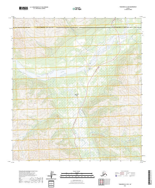
2024 Map of Tanacross A-5 SW
USGS Topo · Published 2024About this map
Mentasta Lake is the primary settlement in this interior Alaskan landscape, positioned near the confluence of local waterways and transport routes. The terrain is defined by the significant drainage of the Tok River and the Little Tok River, which wind through the valleys alongside the Tok Cutoff Highway. This route serves as a vital artery through the region, closely accompanied in several stretches by segments of the Old Tok Cutoff Road. Further south, the map details the passage of Log Cabin Creek and the landmark known as Log Cabin Creek Tri. The map also delineates the transition between the Southeast Fairbanks and Copper River Census Areas, marking a significant political boundary in this portion of the Alaska Range.
Find a feature on this map
14 named features on this map. Tap any name to fly to it.
Don’t see what you’re looking for? This feature index may not catch every label — zoom into the map to look around manually.
Map Details
Editions of this 2024 Tanacross A-5 SW Map
This is the sole edition of this map. No revisions or reprints were ever made.
Other maps of this area

1948 · Tanacross A-6
USGS Topo · 1:63,360

1948 · Nabesna D-5
USGS Topo · 1:63,360

1948 · Tanacross A-5
USGS Topo · 1:63,360

1949 · Tanacross
USGS Topo · 1:250,000

1949 · Nabesna D-6
USGS Topo · 1:63,360

1949 · Tanacross A-5
USGS Topo · 1:63,360

1950 · Tanacross
USGS Topo · 1:250,000

1950 · Nabesna
USGS Topo · 1:250,000

1950 · Nabesna D-5
USGS Topo · 1:63,360

1951 · Nabesna
USGS Topo · 1:250,000