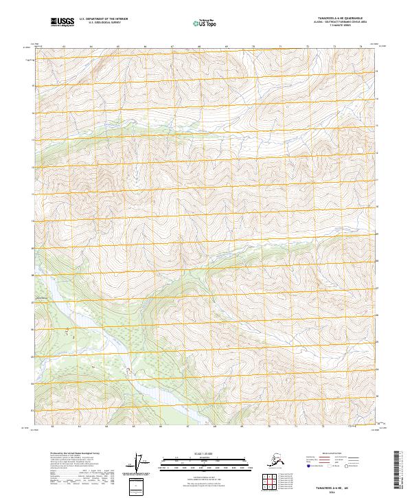
2024 Map of Tanacross A-6 NE
USGS Topo · Published 2024About this map
The Alaska Range defines the high elevation terrain of this subarctic landscape, where a network of glacial and snow-fed waterways carve through the mountains. Braided channels of the Tok River dominate the southwestern corner, joined by Dry Tok Creek as they flow through a broad valley floor characterized by wetlands. This drainage system is a central feature of the local topography, influencing the natural travel corridors and habitat within the Southeast Fairbanks region.
Find a feature on this map
10 named features on this map. Tap any name to fly to it.
Don’t see what you’re looking for? This feature index may not catch every label — zoom into the map to look around manually.
Map Details
Editions of this 2024 Tanacross A-6 NE Map
This is the sole edition of this map. No revisions or reprints were ever made.
Other maps of this area

1948 · Tanacross B-5
USGS Topo · 1:63,360

1948 · Tanacross A-6
USGS Topo · 1:63,360

1948 · Tanacross A-5
USGS Topo · 1:63,360

1949 · Tanacross
USGS Topo · 1:250,000

1949 · Tanacross A-5
USGS Topo · 1:63,360

1949 · Tanacross B-6
USGS Topo · 1:63,360

1950 · Tanacross
USGS Topo · 1:250,000

1951 · Tanacross B-6
USGS Topo · 1:63,360

1952 · Tanacross B-5
USGS Topo · 1:63,360
1952 · Tanacross A-5
USGS Topo · 1:63,360