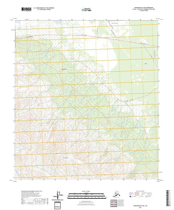
2024 Map of Tanacross B-5 SW
USGS Topo · Published 2024About this map
Tanacross and the neighboring settlement of Tok sit at a vital transportation junction where the Alaska Highway meets the northern foothills of the Alaska Range. This landscape is defined by the transition from the braided wetlands of the Tanana River valley to the high peaks of Mt Neuberger. The mapping shows the critical infrastructure supporting these interior communities, including the Tanacross Airport and a network of local thoroughfares like Tanacross Road Old and Tanacross New Road. South of the highway, the terrain rises sharply, drained by the seasonal flows of Yerrick Creek, Shindata Creek, and Clearwater Creek. The settlement patterns here reflect the mid-century development of the Alaskan interior, centered on the strategic importance of the highway and the traditional river-oriented geography of the region.
Find a feature on this map
18 named features on this map. Tap any name to fly to it.
Don’t see what you’re looking for? This feature index may not catch every label — zoom into the map to look around manually.
Map Details
Editions of this 2024 Tanacross B-5 SW Map
This is the sole edition of this map. No revisions or reprints were ever made.
Other maps of this area

1948 · Tanacross B-5
USGS Topo · 1:63,360

1948 · Tanacross A-6
USGS Topo · 1:63,360

1948 · Tanacross A-5
USGS Topo · 1:63,360

1949 · Tanacross
USGS Topo · 1:250,000

1949 · Tanacross A-5
USGS Topo · 1:63,360

1949 · Tanacross B-6
USGS Topo · 1:63,360

1950 · Tanacross
USGS Topo · 1:250,000

1951 · Tanacross B-6
USGS Topo · 1:63,360

1952 · Tanacross B-5
USGS Topo · 1:63,360
1952 · Tanacross A-5
USGS Topo · 1:63,360