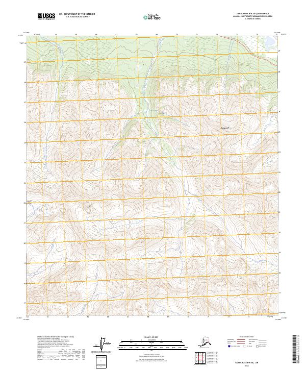
2024 Map of Tanacross B-6 SE
USGS Topo · Published 2024About this map
The Alaska Range foothills dominate this high-latitude terrain within the Southeast Fairbanks Census Area. The landscape is characterized by a complex drainage system where steep elevation changes feed numerous watercourses, most notably Yerrick Creek and the precisely named Cathedral Rapids Creek Number 1. This 2024 data represents the contemporary topography of the Tanacross area, reflecting the natural patterns of the Alaskan interior before the convergence of these headwaters.
Find a feature on this map
10 named features on this map. Tap any name to fly to it.
Don’t see what you’re looking for? This feature index may not catch every label — zoom into the map to look around manually.
Map Details
Editions of this 2024 Tanacross B-6 SE Map
This is the sole edition of this map. No revisions or reprints were ever made.
Other maps of this area

1948 · Tanacross B-5
USGS Topo · 1:63,360

1948 · Tanacross A-6
USGS Topo · 1:63,360

1948 · Tanacross A-5
USGS Topo · 1:63,360

1949 · Tanacross
USGS Topo · 1:250,000

1949 · Tanacross A-5
USGS Topo · 1:63,360

1949 · Tanacross B-6
USGS Topo · 1:63,360

1950 · Tanacross
USGS Topo · 1:250,000

1951 · Tanacross B-6
USGS Topo · 1:63,360

1952 · Tanacross B-5
USGS Topo · 1:63,360
1952 · Tanacross A-5
USGS Topo · 1:63,360