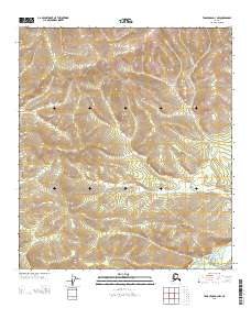
2013 Map of Tanacross D-3 NW
USGS Topo · Published 2013About this map
W Fork Dennison Fork winds through the southern reaches of this landscape in the Southeast Fairbanks region of Alaska, providing a primary drainage route for the surrounding elevation. The terrain is defined by a dense network of ridges and drainages, where Taylor Cr flows southward from the northern slopes. This 2013 survey illustrates a wilderness nearly untouched by modern development, characterized by complex topographic contours that delineate the local watershed. The relationship between these watercourses and the high ground illustrates the natural flow patterns of the Alaskan interior, offering a clear record of the hydrography before any major human-engineered changes altered the drainage basin.
Find a feature on this map
5 named features on this map. Tap any name to fly to it.
Don’t see what you’re looking for? This feature index may not catch every label — zoom into the map to look around manually.
Map Details
Editions of this 2013 Tanacross D-3 NW Map
This is the sole edition of this map. No revisions or reprints were ever made.
Other maps of this area

1949 · Tanacross
USGS Topo · 1:250,000

1950 · Tanacross
USGS Topo · 1:250,000

1951 · Eagle
USGS Topo · 1:250,000

1956 · Tanacross D-3
USGS Topo · 1:63,360

1956 · Tanacross D-4
USGS Topo · 1:63,360

1956 · Eagle A-4
USGS Topo · 1:63,360

1956 · Tanacross
USGS Topo · 1:250,000
1957 · Eagle A-3
USGS Topo · 1:63,360

1957 · Eagle
USGS Topo · 1:250,000

1964 · Tanacross
USGS Topo · 1:250,000