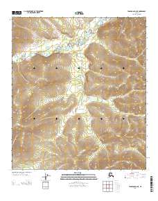
2013 Map of Tanacross D-4 NE
USGS Topo · Published 2013About this map
Mosquito Fork winds through this expanse of Southeast Fairbanks, cutting a distinct path across a landscape defined by sharp elevation shifts and survey boundaries. The map documents the intricate topography of the Alaska interior, where the river's drainage patterns provide the primary geographic anchor within a remote wilderness. The U.S. Geological Survey has recorded the precise township and range lines, including the transition between T 26 N and T 25 N, illustrating how the Public Land Survey System imposes order on this isolated terrain. This survey serves as a fundamental record of the watershed and the complex ridge systems that dominate the region.
Find a feature on this map
4 named features on this map. Tap any name to fly to it.
Don’t see what you’re looking for? This feature index may not catch every label — zoom into the map to look around manually.
Map Details
Editions of this 2013 Tanacross D-4 NE Map
This is the sole edition of this map. No revisions or reprints were ever made.
Other maps of this area

1949 · Tanacross
USGS Topo · 1:250,000

1950 · Tanacross
USGS Topo · 1:250,000

1951 · Eagle
USGS Topo · 1:250,000

1956 · Tanacross D-3
USGS Topo · 1:63,360

1956 · Tanacross D-4
USGS Topo · 1:63,360

1956 · Eagle A-4
USGS Topo · 1:63,360

1956 · Tanacross
USGS Topo · 1:250,000
1957 · Eagle A-3
USGS Topo · 1:63,360

1957 · Eagle
USGS Topo · 1:250,000

1964 · Tanacross
USGS Topo · 1:250,000