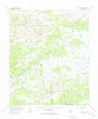
1953 Map of Tanana A-2
USGS Topo · Published 1975About this map
Manley Hot Springs serves as the focal point for this interior Alaskan landscape, which was meticulously documented in the early 1950s. The region is defined by its mining-era infrastructure, featuring an extensive network of Tractor Trails and Sled Roads that navigate the drainages of Baker Creek and its many gold-bearing tributaries. To the north, the prominent Roughtop Mountain and Boulder Ridge dominate the horizon, while the southern portion of the sheet is anchored by Manley Hot Springs Dome and the aptly named Bean Ridge. Geologic and topographic curiosity is piqued by the notation of Pingos and a Pingo near Utah Creek, indicating permafrost features within the drainages. The map records several mining-related sites, including Gold Basin Creek, Ready Money Creek, and Sullivan Creek, alongside a remote Landing Strip and various isolated Cabins, providing a detailed view of the transport and extraction patterns of the era.
Find a feature on this map
63 named features on this map. Tap any name to fly to it.
Don’t see what you’re looking for? This feature index may not catch every label — zoom into the map to look around manually.
Map Details
Editions of this 1953 Tanana A-2 Map
3 editions found
Other maps of this area

1948 · Kantishna River
USGS Topo · 1:250,000

1951 · Kantishna River
USGS Topo · 1:250,000

1951 · Tanana
USGS Topo · 1:250,000

1952 · Tanana A-1
USGS Topo · 1:63,360

1952 · Tanana A-3
USGS Topo · 1:63,360

1952 · Tanana A-2
USGS Topo · 1:63,360

1952 · Kantishna River
USGS Topo · 1:250,000

1952 · Kantishna River D-2
USGS Topo · 1:63,360

1952 · Kantishna River D-3
USGS Topo · 1:63,360

1953 · Tanana A-2
USGS Topo · 1:63,360