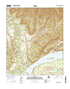
2016 Map of Tanana A-5 NW
USGS Topo · Published 2016About this map
The Yukon River dominates this interior Alaskan landscape, serving as the primary geographic anchor for a network of complex waterways and seasonal sloughs. The topography is defined by the significant confluence where the Tozitna River approaches the main channel, creating a broad lowland area filled with features like Steamboat Slough and Tozitna Slough. This fluvial environment, documented in the 2010s, illustrates the shifting nature of northern watercourses, where islands and sandbars are shaped by the powerful flow of the Yukon.
Find a feature on this map
11 named features on this map. Tap any name to fly to it.
Don’t see what you’re looking for? This feature index may not catch every label — zoom into the map to look around manually.
Map Details
Editions of this 2016 Tanana A-5 NW Map
This is the sole edition of this map. No revisions or reprints were ever made.
Other maps of this area

1951 · Tanana
USGS Topo · 1:250,000

1952 · Tanana A-6
USGS Topo · 1:63,360

1952 · Tanana A-5
USGS Topo · 1:63,360

1953 · Tanana A-5
USGS Topo · 1:63,360

1956 · Tanana B-5
USGS Topo · 1:63,360

1956 · Tanana B-6
USGS Topo · 1:63,360

1956 · Tanana
USGS Topo · 1:250,000

1960 · Tanana
USGS Topo · 1:250,000
2016 · Tanana A-5 SE
USGS Topo · 1:25,000
2016 · Tanana B-5 SW
USGS Topo · 1:25,000