
1956 Map of Tanana B-6
USGS Topo · Published 1960About this map
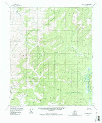
The Tozitna River winds through the eastern edge of this mid-century Alaskan interior landscape, a region defined by its drainage basins and isolated mining activity. Prominent high points like Moran Dome, Grant Dome, and Lynx Dome overlook a network of waterways including Tozimoran Creek and Slate Creek. Infrastructure is sparse and utilitarian, represented by a single Airstrip and a Tractor Trail that provides the primary overland access through the valley of Golden Creek. A solitary Cabin and a Placer Mine near Gold Hill point to the remote subsistence and extraction economy of the area during the 1950s. The map illustrates a transitional period of survey, where traditional mining sites like those on American Creek were being documented alongside early aviation infrastructure.
Find a feature on this map
21 named features on this map. Tap any name to fly to it.
Don’t see what you’re looking for? This feature index may not catch every label — zoom into the map to look around manually.
Map Details
Editions of this 1956 Tanana B-6 Map
2 editions found
Other maps of this area

1951 · Melozitna
USGS Topo · 1:250,000

1951 · Tanana
USGS Topo · 1:250,000

1952 · Tanana A-6
USGS Topo · 1:63,360

1952 · Tanana A-5
USGS Topo · 1:63,360

1952 · Melozitna A-1
USGS Topo · 1:63,360

1953 · Tanana A-5
USGS Topo · 1:63,360

1956 · Melozitna C-1
USGS Topo · 1:63,360

1956 · Melozitna B-1
USGS Topo · 1:63,360

1956 · Tanana B-5
USGS Topo · 1:63,360

1956 · Tanana C-6
USGS Topo · 1:63,360