
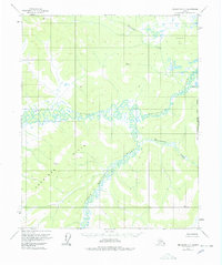
1956 Map of Melozitna C-1
USGS Topo · Published 1959About this map
The confluence of the Melozitna River and the Little Melozitna River anchors this mid-century survey of the Alaskan interior. This remote landscape, characterized by intricate river meanders and vast wetlands, is framed by the elevated terrain of the Kokrines Hills to the southwest. The mapping reflects a period when aerial photogrammetry was refining our understanding of the Yukon-Koyukuk region, identifying specific high points such as Vabm 2044 Wolf and Vabm 2123 Winter. These benchmarks serve as critical survey control points in a wilderness without roads or established settlements. Smaller drainages like Tokatjikh Creek and Melozimoran Creek snake through the valleys, illustrating the complex hydrology of the Melozitna basin during the 1950s.
Find a feature on this map
10 named features on this map. Tap any name to fly to it.
Don’t see what you’re looking for? This feature index may not catch every label — zoom into the map to look around manually.
Map Details
Editions of this 1956 Melozitna C-1 Map
2 editions found
Other maps of this area

1951 · Melozitna
USGS Topo · 1:250,000

1951 · Tanana
USGS Topo · 1:250,000

1952 · Melozitna D-1
USGS Topo · 1:63,360

1955 · Melozitna D-2
USGS Topo · 1:63,360

1956 · Melozitna B-2
USGS Topo · 1:63,360

1956 · Melozitna B-1
USGS Topo · 1:63,360
1956 · Melozitna C-2
USGS Topo · 1:63,360

1956 · Tanana B-6
USGS Topo · 1:63,360

1956 · Tanana C-6
USGS Topo · 1:63,360

1956 · Tanana D-6
USGS Topo · 1:63,360