
1956 Map of Tanana D-6
USGS Topo · Published 1960About this map
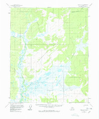
The Tanana-Allakaket Winter Trail cuts a north-south path through this mid-century interior landscape, serving as a vital overland link across the unsurveyed wilderness of the Yukon-Koyukuk region. This 1956 survey, compiled from early 1950s aerial photography, documents a complex network of waterways dominated by the meandering Melozitna River and the prominent Sithylemenkat Lake to the south. The terrain is defined by the Slokhenjikh Hills, where elevations rise above the surrounding wetlands and creek beds. A solitary Cabin situated along the lower reach of Nethkahatie Creek reflects the sparse, seasonal human presence in a territory largely governed by the rhythms of the water and the trail. The map captures the hydrography of the era with precision, including the courses of Kodosin Nolitna Creek and Slokhenjikh Creek as they drain the high country.
Find a feature on this map
10 named features on this map. Tap any name to fly to it.
Don’t see what you’re looking for? This feature index may not catch every label — zoom into the map to look around manually.
Map Details
Editions of this 1956 Tanana D-6 Map
3 editions found
Other maps of this area

1951 · Hughes
USGS Topo · 1:250,000

1951 · Melozitna
USGS Topo · 1:250,000

1951 · Bettles
USGS Topo · 1:250,000

1951 · Tanana
USGS Topo · 1:250,000

1952 · Melozitna D-1
USGS Topo · 1:63,360

1955 · Hughes A-1
USGS Topo · 1:63,360

1956 · Hughes
USGS Topo · 1:250,000

1956 · Bettles
USGS Topo · 1:250,000

1956 · Melozitna C-1
USGS Topo · 1:63,360

1956 · Tanana C-6
USGS Topo · 1:63,360