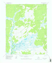
1956 Map of Tanana D-6
USGS Topo · Published 1978About this map
The Slokhenjikh Hills dominate the interior landscape of this 1950s Alaskan territory, marking a high divide between several complex drainage systems. To the west, the Melozitna River meanders through a broad valley, joined by tributaries such as Sithdandit Creek and Tobatokh Creek. The region is defined by its seasonal mobility and remote outposts, evidenced by the presence of a lone Cabin and the Tanana-Allakaket Winter Trail, which cuts across the central wetlands and hills to connect distant settlements. The landscape transitions from high ridgelines into vast marshy lowlands surrounding Norseman Lake and the braided reaches of Slokhenjikh Creek. These features illustrate the traditional winter transport corridors used in the Yukon-Koyukuk region before more permanent road infrastructure was established.
Find a feature on this map
10 named features on this map. Tap any name to fly to it.
Don’t see what you’re looking for? This feature index may not catch every label — zoom into the map to look around manually.
Map Details
Editions of this 1956 Tanana D-6 Map
3 editions found

Other maps of this area

1951 · Hughes
USGS Topo · 1:250,000

1951 · Melozitna
USGS Topo · 1:250,000

1951 · Bettles
USGS Topo · 1:250,000

1951 · Tanana
USGS Topo · 1:250,000

1952 · Melozitna D-1
USGS Topo · 1:63,360

1955 · Hughes A-1
USGS Topo · 1:63,360

1956 · Hughes
USGS Topo · 1:250,000

1956 · Bettles
USGS Topo · 1:250,000

1956 · Melozitna C-1
USGS Topo · 1:63,360

1956 · Tanana C-6
USGS Topo · 1:63,360