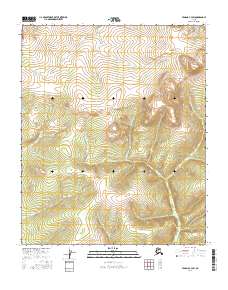
2016 Map of Tanana B-4 SW
USGS Topo · Published 2016About this map
Ptarmigan Cr carves through the northern reaches of this landscape, a remote section of the Yukon-Koyukuk region characterized by significant elevation changes and deep drainage basins. The terrain is defined by the high divides between the watercourses of Jackson Cr and Mission Cr, illustrating the complex hydrological network of the Alaskan interior before these waters eventually join larger river systems. Surveyed for the t6n r21w and t5n r21w townships, the map provides a precise record of the natural topography in an area devoid of permanent settlements or road infrastructure. This 2016 survey is an essential resource for understanding the untouched wilderness and the natural flow of mountain streams in this specific corner of Alaska.
Find a feature on this map
9 named features on this map. Tap any name to fly to it.
Don’t see what you’re looking for? This feature index may not catch every label — zoom into the map to look around manually.
Map Details
Editions of this 2016 Tanana B-4 SW Map
This is the sole edition of this map. No revisions or reprints were ever made.
Other maps of this area

1951 · Tanana
USGS Topo · 1:250,000

1952 · Tanana A-4
USGS Topo · 1:63,360

1952 · Tanana A-5
USGS Topo · 1:63,360

1953 · Tanana A-5
USGS Topo · 1:63,360

1956 · Tanana B-5
USGS Topo · 1:63,360

1956 · Tanana B-4
USGS Topo · 1:63,360

1956 · Tanana
USGS Topo · 1:250,000

1960 · Tanana
USGS Topo · 1:250,000
2016 · Tanana B-4 SE
USGS Topo · 1:25,000
2016 · Tanana B-5 NE
USGS Topo · 1:25,000