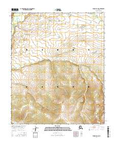
2016 Map of Tanana B-5 NE
USGS Topo · Published 2016About this map
The Tozitna River winds through the northern reaches of this interior Alaskan landscape, a region defined by high ridges and drainage networks far from established settlements. In the southern portion of the quadrangle, the terrain rises significantly towards the interior uplands, where small tributaries like Hellbent Cr originate. The center of the sheet is dominated by the valley of Reindeer Cr, which flows eastward, carving a path through the steep contour gradients that characterize the local topography. This 2016 survey illustrates a completely undeveloped wilderness within the Public Land Survey System townships of t8n r22w and t7n r23w, where the only named features are the waterways that serve as the primary landmarks for navigation and land management in the Yukon-Koyukuk region.
Find a feature on this map
10 named features on this map. Tap any name to fly to it.
Don’t see what you’re looking for? This feature index may not catch every label — zoom into the map to look around manually.
Map Details
Editions of this 2016 Tanana B-5 NE Map
This is the sole edition of this map. No revisions or reprints were ever made.
Other maps of this area

1951 · Tanana
USGS Topo · 1:250,000

1956 · Tanana B-5
USGS Topo · 1:63,360

1956 · Tanana C-5
USGS Topo · 1:63,360

1956 · Tanana C-4
USGS Topo · 1:63,360

1956 · Tanana B-4
USGS Topo · 1:63,360

1956 · Tanana
USGS Topo · 1:250,000

1960 · Tanana
USGS Topo · 1:250,000
2016 · Tanana B-5 SW
USGS Topo · 1:25,000
2016 · Tanana B-5 NW
USGS Topo · 1:25,000
2016 · Tanana C-5 SE
USGS Topo · 1:25,000