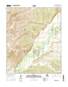
2016 Map of Tanana B-5 NW
USGS Topo · Published 2016About this map
The Tozitna River dominates this interior Alaskan landscape, winding through a complex network of oxbows and abandoned river channels in the southeastern quadrant. This 2016 survey shows the river's meandering course as it carves through the transition between high ridges and valley floors. Smaller tributaries such as Reindeer Cr and Hellbent Cr drain the surrounding slopes, reflecting a wilderness untouched by modern infrastructure. The topography is defined by significant elevation changes, with the ridges of the Tanana region rising sharply above the river basin. This map serves as a precise record of the hydrologic patterns and natural drainage systems within the Yukon-Koyukuk area, illustrating how the watercourses have shaped the remote terrain over time.
Find a feature on this map
9 named features on this map. Tap any name to fly to it.
Don’t see what you’re looking for? This feature index may not catch every label — zoom into the map to look around manually.
Map Details
Editions of this 2016 Tanana B-5 NW Map
This is the sole edition of this map. No revisions or reprints were ever made.
Other maps of this area

1951 · Tanana
USGS Topo · 1:250,000

1956 · Tanana B-5
USGS Topo · 1:63,360

1956 · Tanana B-6
USGS Topo · 1:63,360

1956 · Tanana C-6
USGS Topo · 1:63,360

1956 · Tanana C-5
USGS Topo · 1:63,360

1956 · Tanana
USGS Topo · 1:250,000

1960 · Tanana
USGS Topo · 1:250,000
2016 · Tanana B-5 SW
USGS Topo · 1:25,000
2016 · Tanana B-5 NE
USGS Topo · 1:25,000
2016 · Tanana C-5 SE
USGS Topo · 1:25,000