
1956 Map of Tanana C-5
USGS Topo · Published 1960About this map
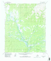
The Tanana-Allakaket Winter Trail bisects this interior Alaskan landscape, providing a critical transport link through the marshy lowlands and upland drainages during the mid-1950s. This survey, based on aerial photography from 1952, documents a region defined by its complex hydrology, where the Dagislakhna River and the Tozitna River wind through a mosaic of wetlands. A solitary Cabin situated along the lower reaches of Dagislakhna Creek represents the only named structure in this expansive territory, suggesting a seasonal or subsistence-based occupancy typical of the era. The mapping of smaller tributaries like Wrongtrail Creek and Banddana Creek reveals the intricate drainage patterns of the Yukon-Koyukuk region before significant modern development, capturing the area in a state primarily used for hunting, trapping, and winter travel.
Find a feature on this map
10 named features on this map. Tap any name to fly to it.
Don’t see what you’re looking for? This feature index may not catch every label — zoom into the map to look around manually.
Map Details
Editions of this 1956 Tanana C-5 Map
3 editions found
Other maps of this area

1951 · Tanana
USGS Topo · 1:250,000

1956 · Tanana B-5
USGS Topo · 1:63,360

1956 · Tanana D-4
USGS Topo · 1:63,360

1956 · Tanana B-6
USGS Topo · 1:63,360

1956 · Tanana C-6
USGS Topo · 1:63,360

1956 · Tanana D-6
USGS Topo · 1:63,360
1956 · Tanana D-5
USGS Topo · 1:63,360

1956 · Tanana C-4
USGS Topo · 1:63,360

1956 · Tanana B-4
USGS Topo · 1:63,360

1956 · Tanana
USGS Topo · 1:250,000