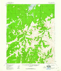
1956 Map of Tanana D-5
USGS Topo · Published 1960About this map
Hokotada Creek and Nethkati Creek carve through the interior wilderness of the Yukon-Koyukuk region, defining a landscape dominated by unnamed peaks and ridges. This mid-century survey, based on aerial photography from the early 1950s, documents a remote section of the Alaskan interior before modern development. The drainage patterns of the North Fork and Dagislakhna Creek suggest a complex hydrology where steep Mountains meet low-lying swampy areas in the north. The map reflects a period of extensive federal surveying where land lines were predetermined by the Bureau of Land Management but remained largely unsurveyed on the ground, emphasizing the isolated nature of this terrain during the territorial-to-statehood transition.
Find a feature on this map
5 named features on this map. Tap any name to fly to it.
Don’t see what you’re looking for? This feature index may not catch every label — zoom into the map to look around manually.
Map Details
Editions of this 1956 Tanana D-5 Map
2 editions found
Other maps of this area

1951 · Bettles
USGS Topo · 1:250,000

1951 · Tanana
USGS Topo · 1:250,000

1956 · Bettles
USGS Topo · 1:250,000

1956 · Tanana D-4
USGS Topo · 1:63,360

1956 · Tanana C-6
USGS Topo · 1:63,360

1956 · Tanana D-6
USGS Topo · 1:63,360

1956 · Tanana C-5
USGS Topo · 1:63,360

1956 · Tanana C-4
USGS Topo · 1:63,360

1956 · Tanana
USGS Topo · 1:250,000

1960 · Tanana
USGS Topo · 1:250,000