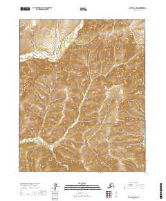
2017 Map of Tanana C-2 SW
USGS Topo · Published 2017About this map
Tozitna River winds through this interior landscape of the Yukon-Koyukuk region, marking the northern drainage of a high-elevation plateau. The terrain is defined by its watershed patterns, where tributaries like Padlight Cr flow into the main river valley from the surrounding ridges. To the south, the headwaters of Canyon Cr and Moose Cr indicate the presence of a significant topographic divide that separates these western-flowing waters. This 2017 survey by the U.S. Geological Survey provides a precise visualization of the wilderness contours and hydrographic networks within the Tanana C-2 SW quadrangle, showing a land devoid of established roads or permanent settlements at the time of the imagery.
Find a feature on this map
9 named features on this map. Tap any name to fly to it.
Don’t see what you’re looking for? This feature index may not catch every label — zoom into the map to look around manually.
Map Details
Editions of this 2017 Tanana C-2 SW Map
This is the sole edition of this map. No revisions or reprints were ever made.
Other maps of this area

1951 · Tanana
USGS Topo · 1:250,000

1956 · Tanana B-2
USGS Topo · 1:63,360

1956 · Tanana C-3
USGS Topo · 1:63,360

1956 · Tanana B-3
USGS Topo · 1:63,360

1956 · Tanana C-2
USGS Topo · 1:63,360

1956 · Tanana
USGS Topo · 1:250,000

1960 · Tanana
USGS Topo · 1:250,000
2016 · Tanana B-3 NE
USGS Topo · 1:25,000
2016 · Tanana C-3 NE
USGS Topo · 1:25,000
2016 · Tanana C-3 SE
USGS Topo · 1:25,000