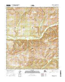
2016 Map of Tanana C-3 SE
USGS Topo · Published 2016About this map
The Tozitna River winds through this interior Alaskan wilderness, cutting through a landscape defined by sharp elevation changes and deep valleys. This survey, produced by the U.S. Geological Survey in the mid-2010s, illustrates the complex hydrography of the region as several drainages converge. Notable watercourses include Sam Cr flowing from the north and Canyon Cr in the southeast, both tributaries that feed into the larger river system. The map provides a precise record of the natural terrain and township boundaries, including t9n r17w and t8n r17w, in a part of the state where human development remains absent. The relief data and stream patterns offer critical insights for those studying the remote hydrological networks of the Yukon-Koyukuk region.
Find a feature on this map
7 named features on this map. Tap any name to fly to it.
Don’t see what you’re looking for? This feature index may not catch every label — zoom into the map to look around manually.
Map Details
Editions of this 2016 Tanana C-3 SE Map
This is the sole edition of this map. No revisions or reprints were ever made.
Other maps of this area

1951 · Tanana
USGS Topo · 1:250,000

1956 · Tanana B-2
USGS Topo · 1:63,360

1956 · Tanana C-3
USGS Topo · 1:63,360

1956 · Tanana B-3
USGS Topo · 1:63,360

1956 · Tanana C-2
USGS Topo · 1:63,360

1956 · Tanana
USGS Topo · 1:250,000

1960 · Tanana
USGS Topo · 1:250,000
2016 · Tanana B-3 NE
USGS Topo · 1:25,000
2016 · Tanana B-3 NW
USGS Topo · 1:25,000
2016 · Tanana C-3 SW
USGS Topo · 1:25,000