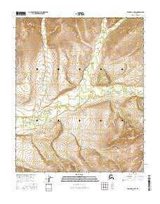
2016 Map of Tanana C-3 SW
USGS Topo · Published 2016About this map
Tozitna River meanders across this northern landscape, forming the primary drainage through a territory defined by sharp elevation shifts and steep-sided creek valleys. In this remote portion of the Yukon-Koyukuk region, the hydrology is dominated by Fleshlanana Cr and Gishna Cr, which carve through the high terrain to meet the main river channel. The map provides a precise look at the township and range boundaries, including t9n r19w and t8n r18w, which organize this largely unsettled wilderness. The absence of roads or permanent structures underscores the isolation of the area, making the watercourses the most significant landmarks for navigation and geographic study.
Find a feature on this map
7 named features on this map. Tap any name to fly to it.
Don’t see what you’re looking for? This feature index may not catch every label — zoom into the map to look around manually.
Map Details
Editions of this 2016 Tanana C-3 SW Map
This is the sole edition of this map. No revisions or reprints were ever made.
Other maps of this area

1951 · Tanana
USGS Topo · 1:250,000

1956 · Tanana C-3
USGS Topo · 1:63,360

1956 · Tanana B-3
USGS Topo · 1:63,360

1956 · Tanana C-4
USGS Topo · 1:63,360

1956 · Tanana B-4
USGS Topo · 1:63,360

1956 · Tanana
USGS Topo · 1:250,000

1960 · Tanana
USGS Topo · 1:250,000
2016 · Tanana B-3 NE
USGS Topo · 1:25,000
2016 · Tanana B-3 NW
USGS Topo · 1:25,000
2016 · Tanana C-4 SE
USGS Topo · 1:25,000