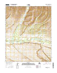
2016 Map of Tanana C-4 SE
USGS Topo · Published 2016About this map
The Tozitna River meanders across the central portion of this interior Alaska wilderness, serving as the primary geographical focal point of the landscape. This 2016 survey highlights a remote corridor of the Yukon-Koyukuk region where the river basin transitions into higher elevations. To the north, the terrain rises steadily toward the drainage of McQuesten Cr, a significant tributary flowing through the township of T9N R20W. The lack of man-made structures or roads emphasizes the natural state of this subarctic environment, where topography is defined by the waterway's path through the valley. This map provides an essential baseline for understanding the hydrology and land contours of the Alaskan interior before modern development or environmental shifts significantly alter the drainage patterns.
Find a feature on this map
6 named features on this map. Tap any name to fly to it.
Don’t see what you’re looking for? This feature index may not catch every label — zoom into the map to look around manually.
Map Details
Editions of this 2016 Tanana C-4 SE Map
This is the sole edition of this map. No revisions or reprints were ever made.
Other maps of this area

1951 · Tanana
USGS Topo · 1:250,000

1956 · Tanana C-3
USGS Topo · 1:63,360

1956 · Tanana B-3
USGS Topo · 1:63,360

1956 · Tanana C-4
USGS Topo · 1:63,360

1956 · Tanana B-4
USGS Topo · 1:63,360

1956 · Tanana
USGS Topo · 1:250,000

1960 · Tanana
USGS Topo · 1:250,000
2016 · Tanana C-4 NW
USGS Topo · 1:25,000
2016 · Tanana B-3 NW
USGS Topo · 1:25,000
2016 · Tanana C-3 SW
USGS Topo · 1:25,000